 " />
" /> 
A hike lasting about 6 hours, classified as difficult, starting from the village of Clamensane.
From Clamensane and its cemetery, climb to the top of the village. A pretty path leads you to the Graves road which you follow for 500m before turning right onto a wide track.
For almost 2 hours, this track will guide you to the Col de la Croix.
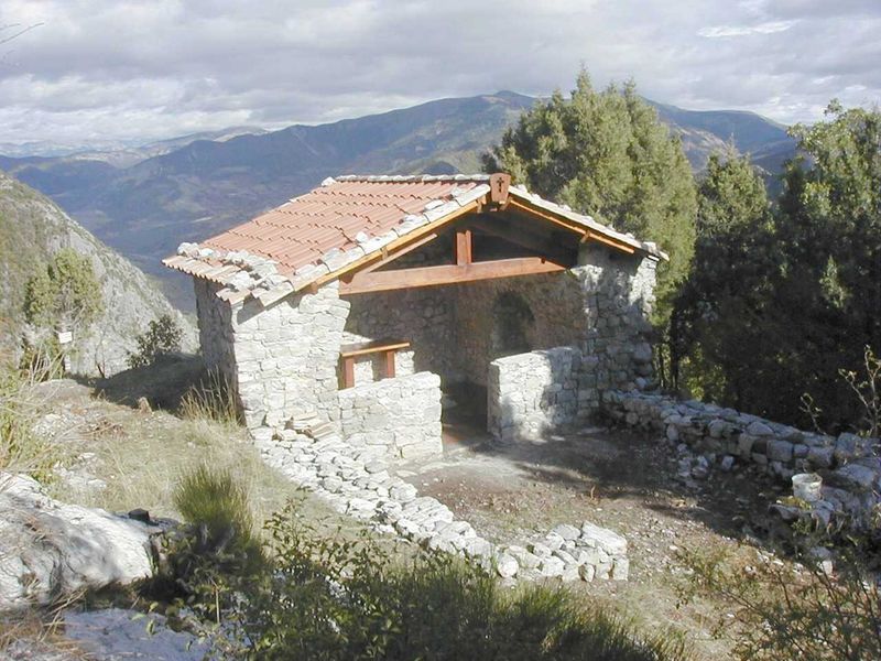
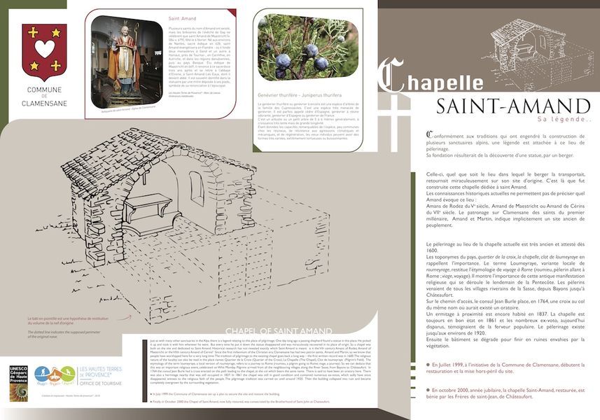
A path finally takes over to bring you, after passing through a beautiful scree, to the foot of the chapel and its terrace overlooking the valley of the Sasse. Up until the 1920s, a procession that started in the whole valley ended here the day after Pentecost. The descent, more direct towards Clamensane, winds through an oak grove to the Naïsses ravine and its hemp basins. Finally, the D1 brings you back to your starting point, without forgetting, if you feel thirsty, the refreshment bar at the Clos du Jay campsite.
Bureau d’accueil des Via Ferrata
04250 Clamensane
Telephone : +33492684039
Email : [email protected]
To download : INFORMATIONS PRATIQUES
To download : 2019-fiche-rando-17-chapelle-saint-amand
- Balado
- Biodiversity corridors in PACA
Rates
Free access.- Level red – hard
Opening dates
All year round.- French


Updated on 07/03/2024 – Office de Tourisme Sisteron Buëch – Suggest an edit