 " />
" /> 
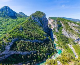
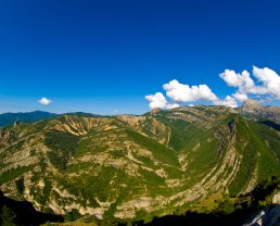
When you take the Route de la Bonette from Jausiers, be prepared for a 1,500 metre climb on the heels of the Tour de France cyclists!
A mythical road
On a bike, a motorbike, by car or camper van… you will feel the gradient and rapidly find yourself high up in the mountains.
Keep your eyes wide open, this is a road that takes you on countless adventures.
Unexpected encounters
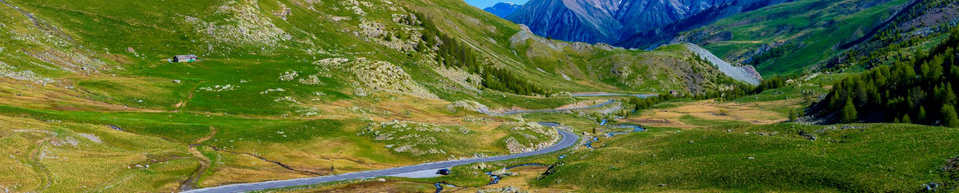
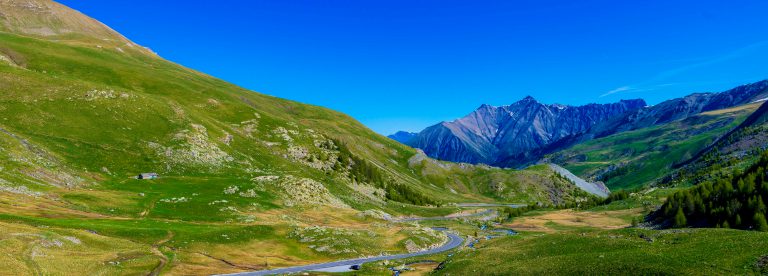
After the first few bends, you will be surrounded by green pastures and torrents and, as you come around a bend you will be surprised by the sheer height and thundering noise of a waterfall.
A little further on you will see a shepherd’s hut in the middle of mountain pastures, surrounded by a flock of sheep. And a bit higher up you will just have to stop to take photos of a lake.
Watch out for the marmots rushing around the mountain prairies. There are no “marmot crossings”, and they can suddenly rush out into the road in front of you!

In the Mercantour National Park
Keep your ears open because in the middle of all this soothing calm, they will be full of sounds! The bleating of the sheep, whistling marmots, thundering the torrents – and the wind telling us its mountain tales as it blows through the larches…
The scenery changes progressively as you climb and it’s almost as if you were on the moon! The vegetation is more rarefied and the almost unreal landscape is made up of huge rocks and grey stony slopes.
Structures such as former military barracks which used to belong to the Maginot Line of the Alps are still there to remind us of the tensions between France and Italy during WW2.

The top of La Bonette at 2,802 metres
You’ve done it, you’ve reached the pass, but the adventure doesn’t end here!
One last effort andyou’ll get your reward as you climb the road (the highest asphalt road in Europe) which leads to the top of La Bonette at 2,802 metres.
After you’ve taken a photo as a souvenir in front of the monument at the top, a little path takes you up to 2,860 metres and an exceptional panoramic view. The viewpoint finder shows you Mount Viso, Mount Pelat, the Tinée, Italy, etc.
Don’t forget that you are in the Mercantour National Park. It has exceptional and abundant wildlife. If you look up, you may see a rather special vulture: the bearded vulture.
A moment of contemplation at the oratory of Notre-Dame du Très-Haut, the patron saint of the pass and you’re ready for a whale of a descent!

A well-earned rest
To recover from all these emotions, stop off at the Halte 2000 mountain restaurant with its traditional food in an authentic mountain hut.
It’s naturally cool in the high mountains, so the restaurant is ideal for a cool break in summer.
The Col de la Bonette road (altitude 2,715 metres) links the Ubaye Valley in the Alpes de Haute Provence to the Tinée Valley in the Alpes-Maritimes.
The Col de la Bonette and the road are closed in winter, so you’ll have to wait for the snow to melt before going over them. (open from June to October)

Read more
Ubaye tourist information offices : www.ubaye.com/GB/
Mercantour National Park : www.mercantour-parcnational.fr
For cyclists “Brevet des 7 cols de l’Ubaye” : www.ubaye.com/GB/brevet-7-cols-bike.html
For rider “cols des Alpes” : provence-alpes-cotedazur.com/route-des-grandes-alpes/